Fairfield County, Ohio Maps
County location, townships, school districts and the transportation network.
Where Fairfield County sits
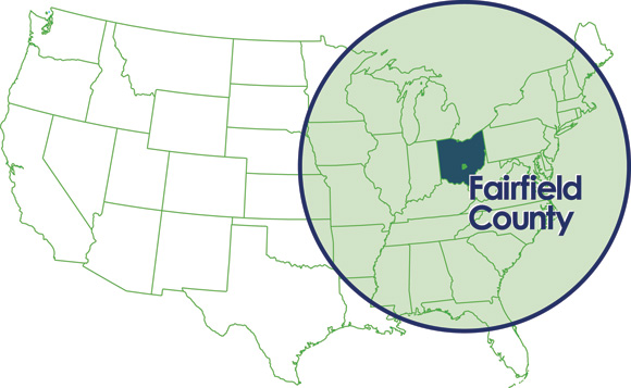
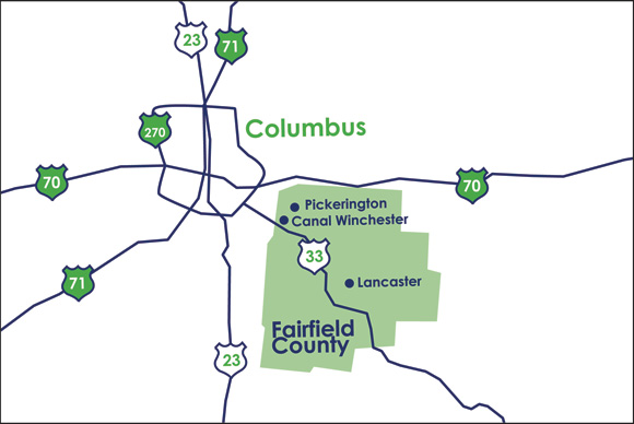
Fairfield County is in central Ohio, directly southeast of Columbus, with Lancaster as its county seat. Interstates 70 and 270 run along its northern edge and US 33 runs diagonally through the county, connecting Lancaster to Columbus in about 30 minutes. Located within a one-day drive or a one-hour flight of nearly half the population of the U.S. and Canada, the Fairfield 33 Corridor is perfectly situated to connect your business with its most important resources.
Regional location map
Fairfield County in relation to Columbus, the interstate system and the wider U.S. market.
Local transportation map
US 33, Interstates 70, 71 and 270, and the county’s position relative to Pickerington, Canal Winchester and Lancaster.
School district map
Public school district boundaries and higher education institutions serving Fairfield County, including Amanda-Clearcreek, Berne Union, Bloom-Carroll, Canal Winchester, Fairfield Union, Lancaster City, Liberty Union-Thurston, Northern, Pickerington, Reynoldsburg, Southwest Licking, Teays Valley and Walnut Township.
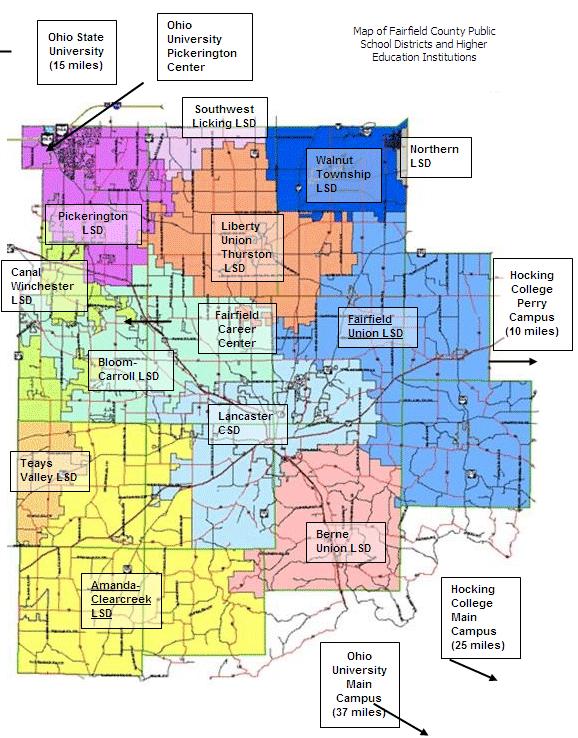
School district and higher education links
Township and zoning maps
Township boundaries and zoning information for the unincorporated areas of the county are maintained by the Regional Planning Commission.
- Fairfield County township and zoning informationRegional Planning Commission
- County road and bridge mapsEngineer’s Office
Available property search
Search industrial, office, retail, land, multi-unit housing and special use properties on an interactive map.